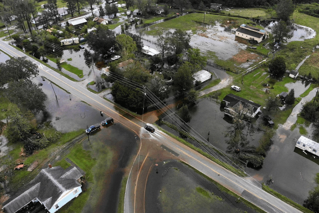
Research Focus
Our lab investigates how water shapes Earth’s landscapes and influences human and environmental systems. This summer, undergraduate researchers will join an interdisciplinary team working to improve predictive flood hazard mapping across vulnerable landscapes in the Mississippi River Basin. Students will integrate field-based monitoring, environmental sensor data, and drone and satellite remote sensing data to explore how floods impact communities in East St. Louis, Illinois, and Shaw, Mississippi.
Skills, Techniques, Methods
- Field sampling and environmental sensor installation in East St. Louis and Shaw, Mississippi
- Environmental data analysis
- Geospatial Science
- Flood Modeling
Research Conditions
The project combines hands-on fieldwork (40%)—including installing sensors, collecting samples, and surveying flood-prone areas—with computational analysis (60%) that leverages flood models, environmental data, and geospatial science. Students will analyze how flood patterns intersect with environmental pathogen distributions and human health data to better understand how environmental hazards impact vulnerable communities.
Team Structure and Opportunities
The WUSTL Geomorphology Lab investigates how water shapes and transforms landscapes and develops methods to measure and predict these patterns across Earth’s surface. As part of this project, students will not only work with members of our lab, but as part of a larger collaborative team spanning environmental science, microbiology, and anthropology. We welcome curious, motivated students eager to connect environmental research with community-relevant challenges. Students will be encouraged to pursue the aspects of the work that most excite them.
Requirements
An introductory earth/environmental science course is preferred. Comfort with basic computational tools (e.g. Microsoft Excel) is preferred, but not required.

Claire Mastellar
cmasteller@wustl.edu